- Douglas Seefeldt, “Cartographic Representations of the American West on the Eve of the Mormon Exodus”
- My essay, “Cartographic Representations of the American West on the Eve of the Mormon Exodus” appears in this collection.
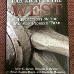
What began as an invited lecture to speak to the faculty of Brigham Young University’s Religious Studies Center in Omaha, NE along the Mormon Pioneer National Historic Trail in the summer of 2012 has just been published! As the lead essay in this collection of twelve pieces, I trace the cartographic ideas of the Far West around the time of the Mormon exodus from Illinois to Utah in the mid-nineteenth century. The essay examines the significant works of cartography featuring the American West created just after the Lewis and Clark expedition through the constitution of the State of Deseret in 1849. These are the depictions of the region that Church leadership used to establish the stake of Zion, the settlement of the Great Basin, the proposed State of Deseret, the creation of Utah Territory, and eventually the state of Utah. I am pleased to see it in print and hope that it is of use to those who study cartography, Mormon history, the American West, and United States history.

